


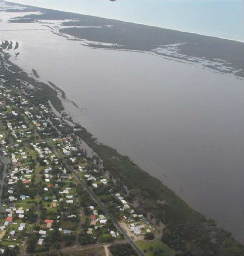
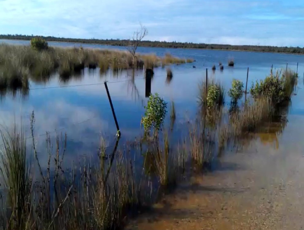
Click Images
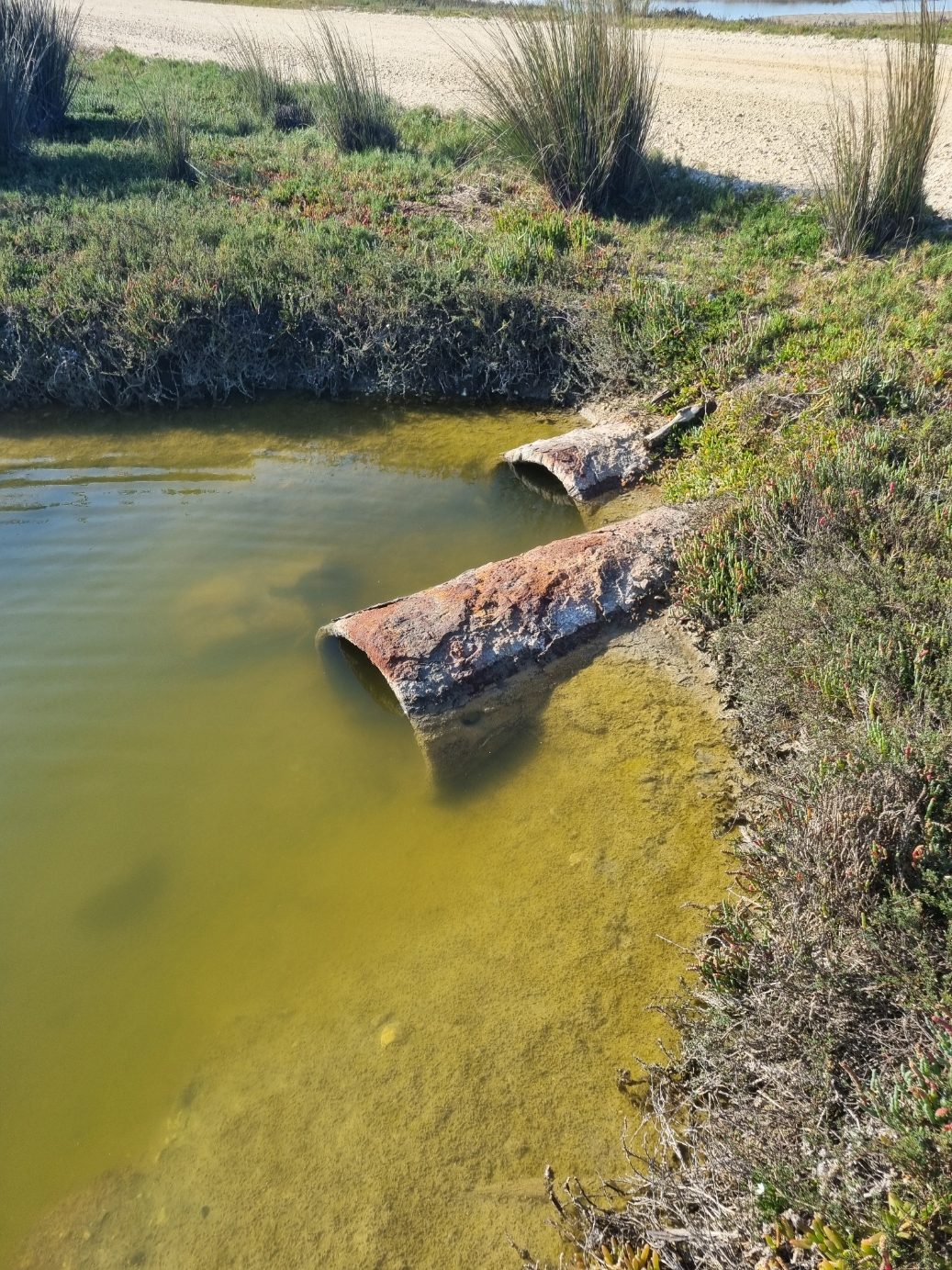
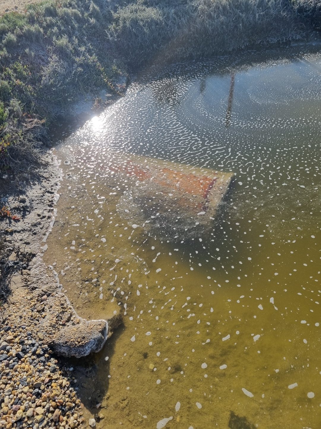
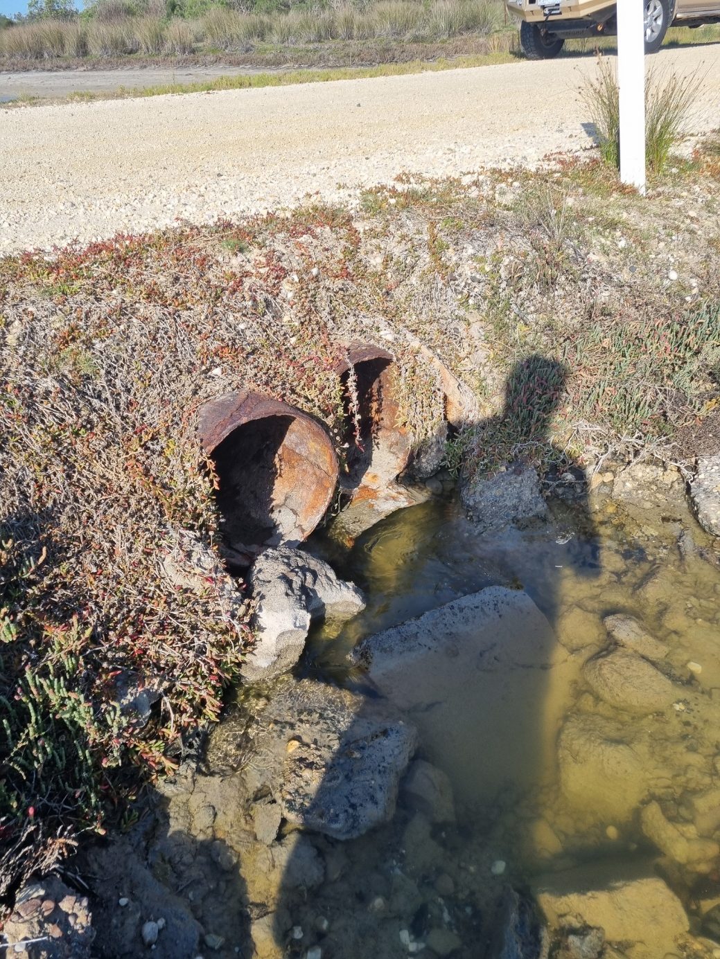
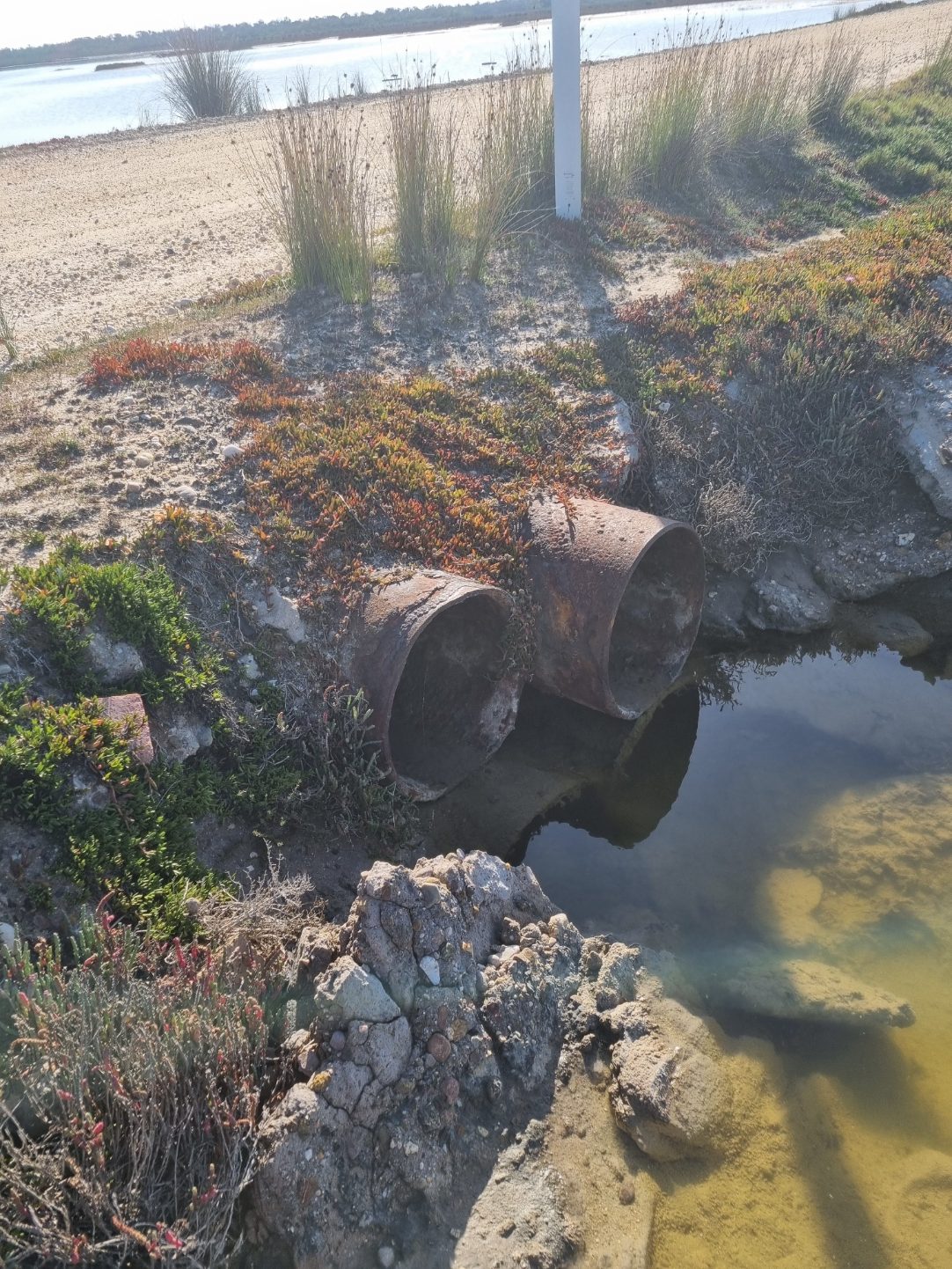
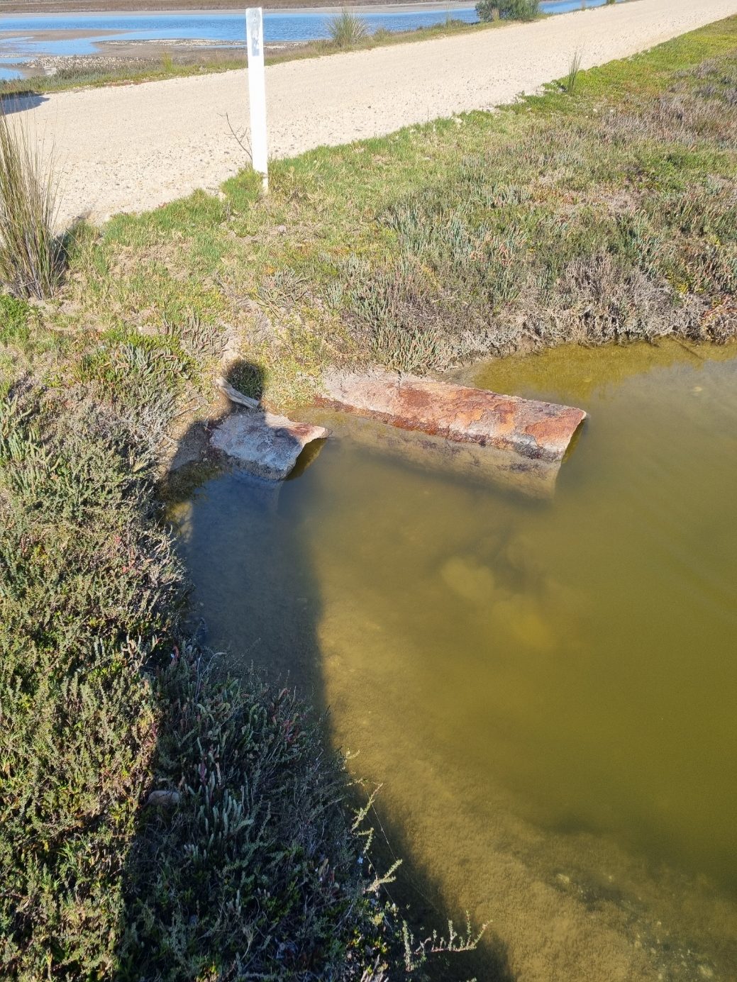
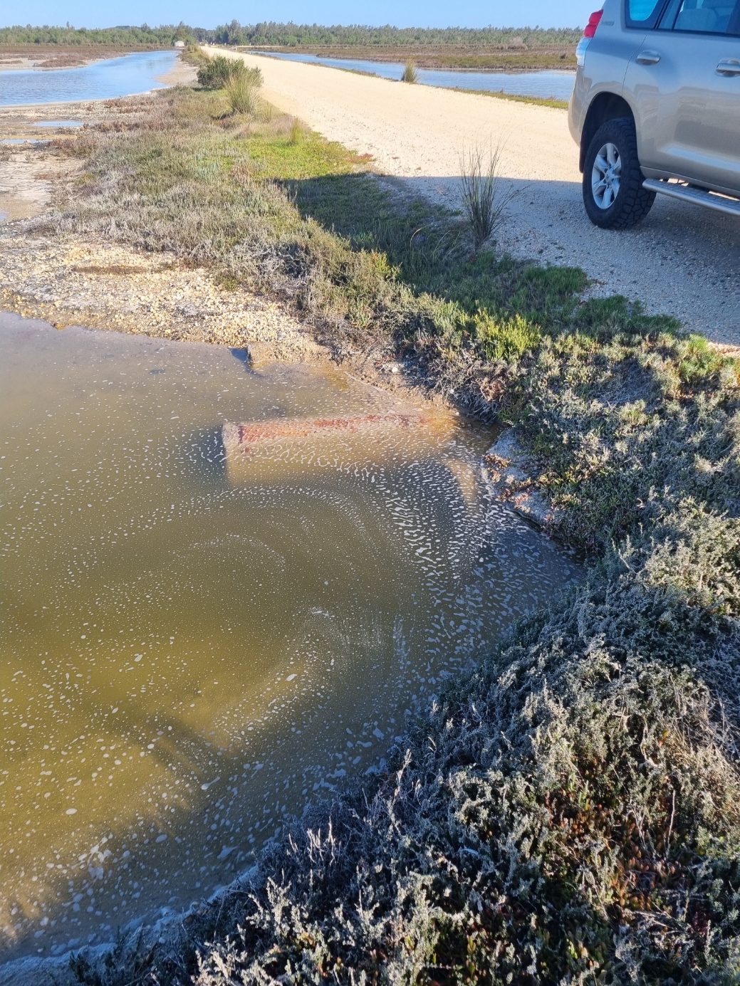
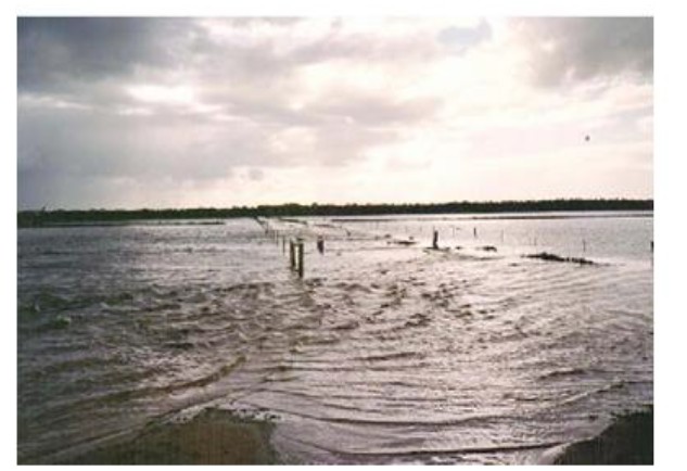
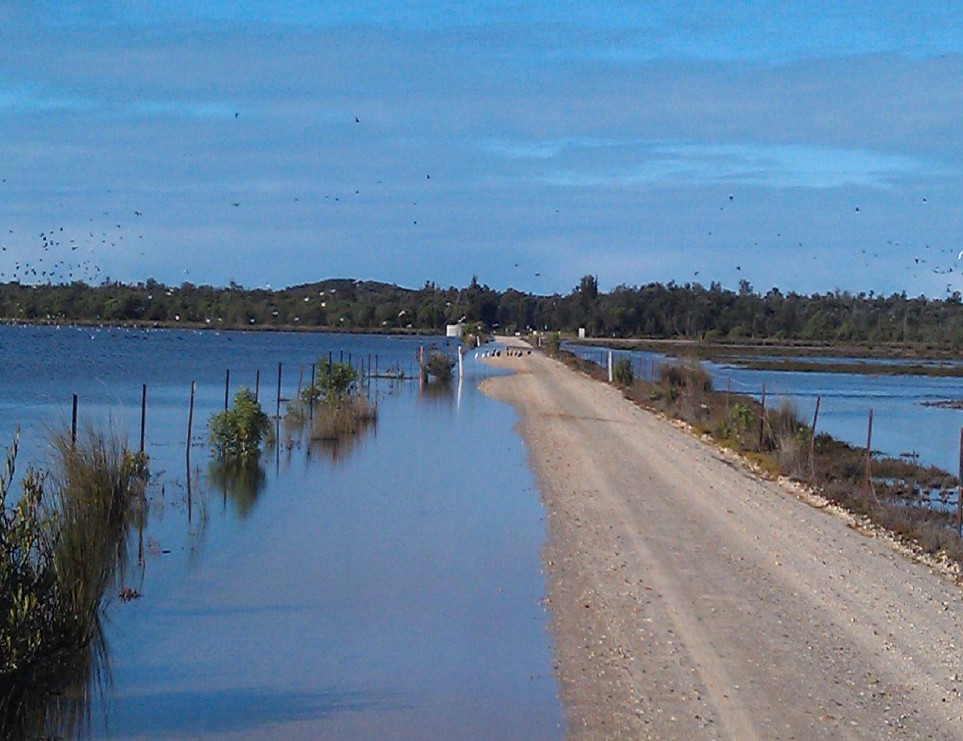
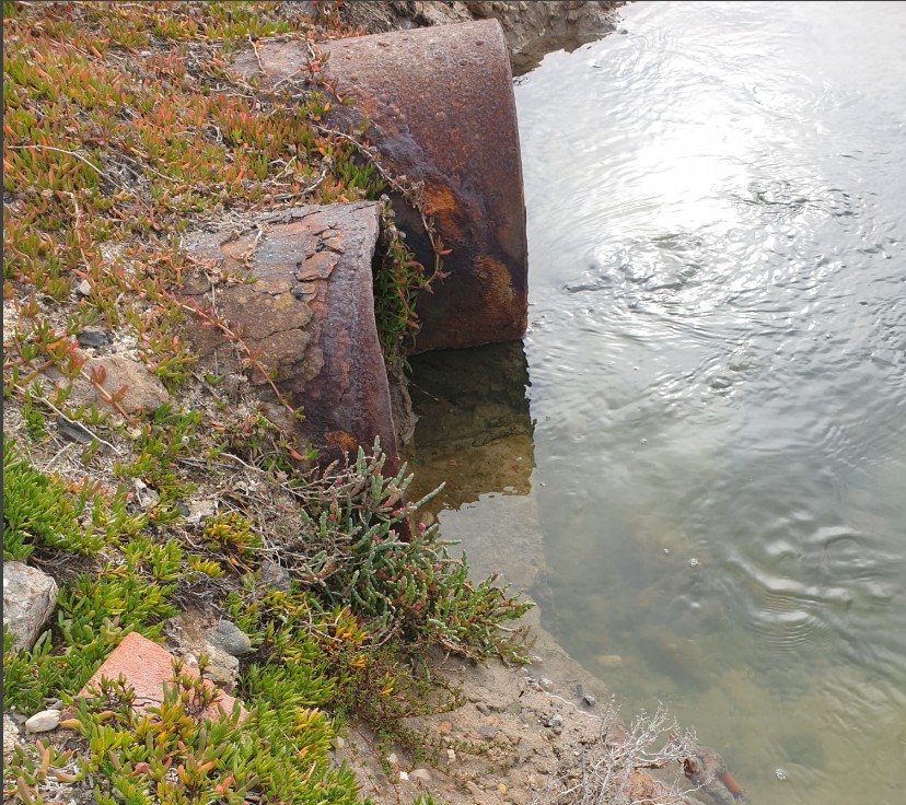
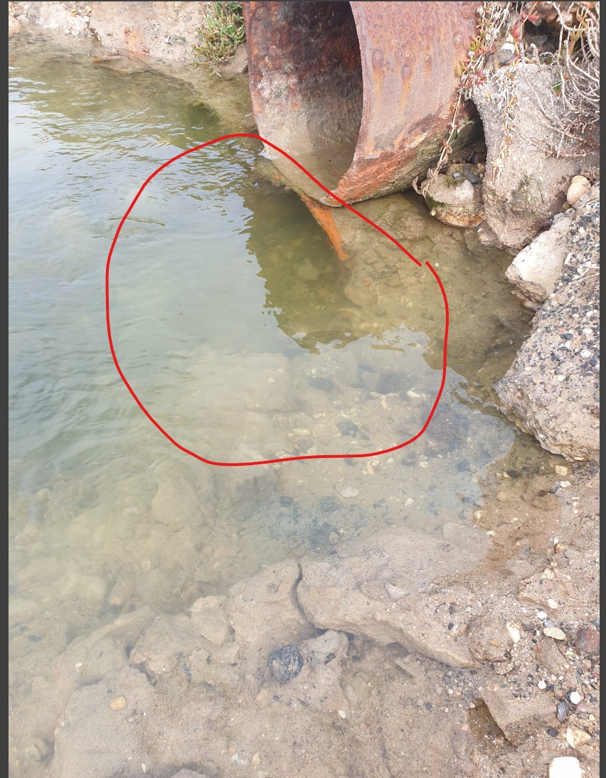
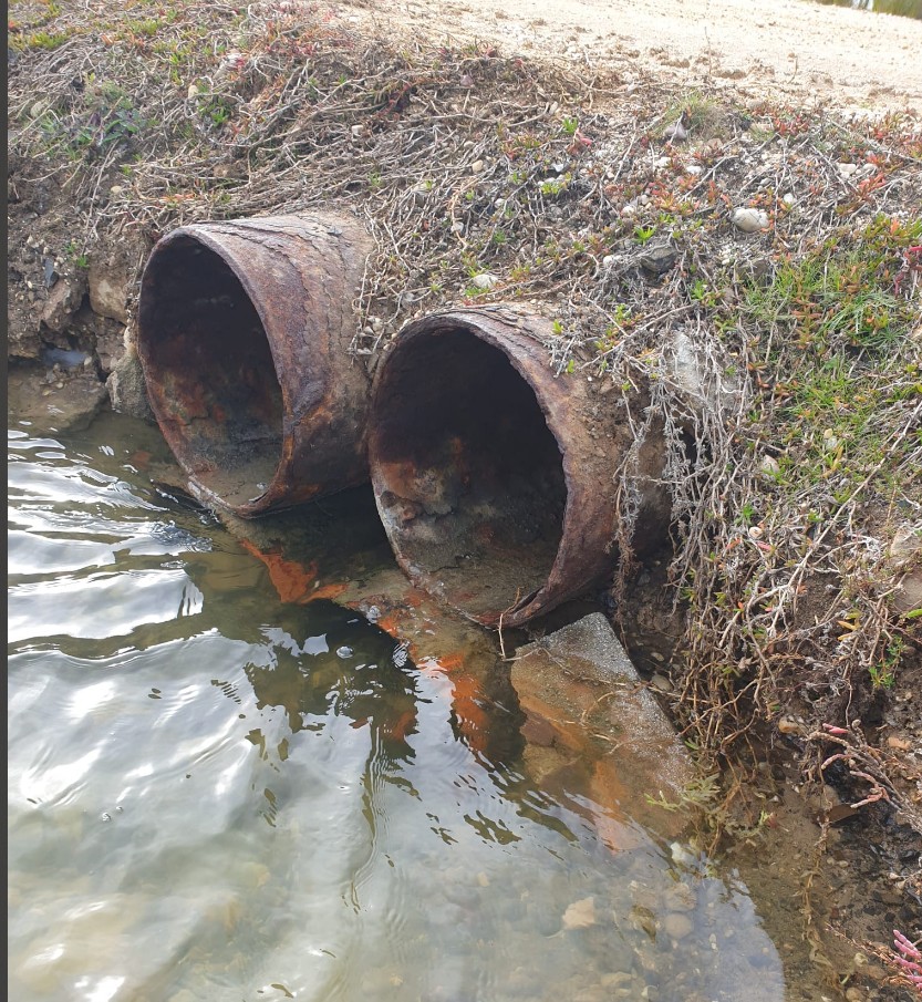
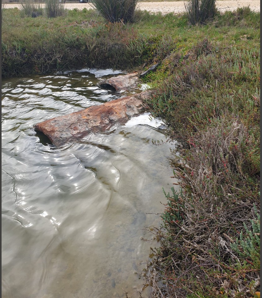
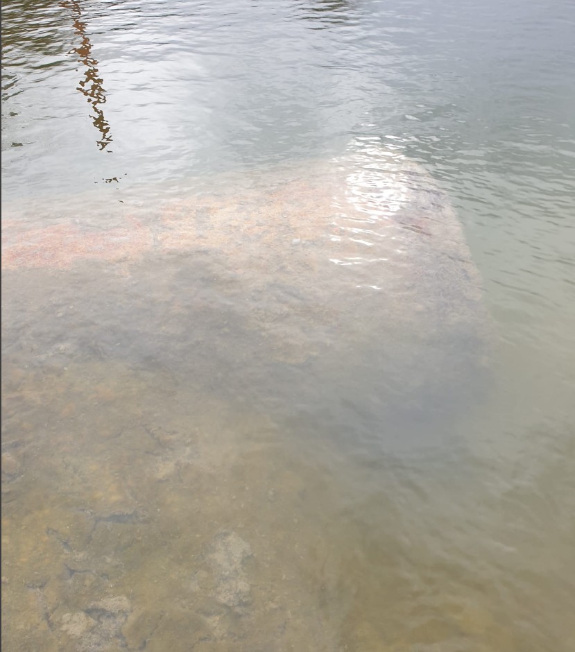
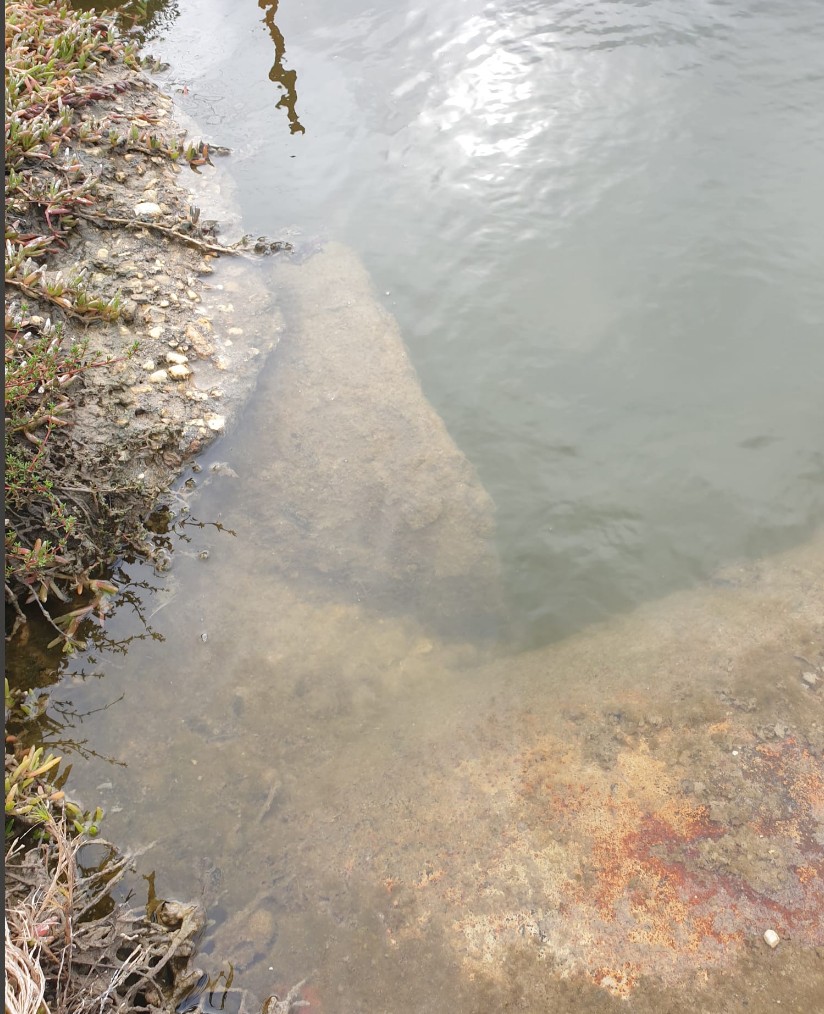
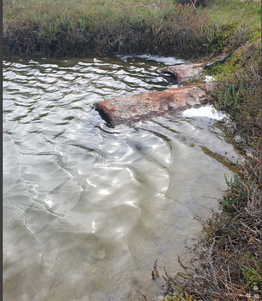
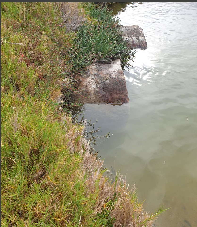
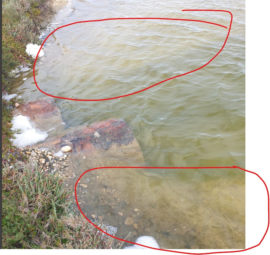
Lack of maintenance and clear evidence of water not flowing away
As evidenced in the first image (1995), Track 10 was originally a low tide causeway. A 1998 permit issued to Santos and the WSC led to its rebuilding and raising for heavy vehicle use. The impact of this alteration is visually demonstrated in the second image of the 2007 floods, where water is shown backing up towards Loch Sport.
Click Images
A controversial flood study that “overnight” rendered some landowners unable to build on their blocks in South Warrnambool has been shelved
After a long debate by city councillors on Monday, June 2, 2025, they voted 4-1 to “make clear” that it did not want to proceed with the recommendations in the flood investigation.
But just what the implications of that decision, and what that means for those properties owners who haven’t been able to build on their land, was something the council now has to work through.
A motion put by Cr Vicki Jellie went against officers’ recommendations seeking to include the study in a planning scheme amendment.
Chief executive officer Andrew Mason said a planning scheme amendment would have ensured existing and future landowners were aware of the flood potential.
It was also a process, he said, that would have provided a pathway for objectors’ concerns to be tested before an independent planning panel.
Decision causes councillors sleepless nights
Cr Jellie said the flood investigation had been a long and arduous task, causing a lot of sleepless nights.
She said councillors were not engineers, scientists or climate change experts and were asked to make a decision now for the next 75 years.
“How can anyone have the insight to do that so far ahead?” she said.
“How do we, with the utmost certainty, know that we can believe this data and supposed science.”
Cr Jellie said some of it had been “undoubtedly an assumption”. “Is the science perfect?,” she asked.
“I’m not to prepared to agree to something that in essence is saying just vote this through and we’ll work out the solutions later. I want clarity.”
Call for reliable state government funding
Councillors called for “reliable” state government funding to look at the whole of Warrnambool, including east of Cassidys Bridge, not just South Warrnambool and Dennington. They also want the government to have a dedicated flood mitigation infrastructure fund.
Councillors raised concerns the role of Rutledges cutting had been downplayed and dismissed in the flood study.
“No matter how focused this study is on data and supposed science, there is a huge human element in this entire process that cannot be ignored,” Cr Jellie said.
She said while residents chose to build, live and invest in those areas, “all of a sudden the rules have changed”, leaving many in a “precarious situation”.
“These people are now being asked to bear the brunt of something that is not in their control or in fact may never happen,” she said.
“The rules changed overnight.
“A 75-year unknown, uncertain decision will stop progress.”
Cr Jellie said the study should have focused on stopping future inappropriate development of land, and left alone what already existed and was under development.
Councillors overloaded with scientific data
Labelling it one of the most difficult decisions facing councillors, Cr Debbie Arnott said they had been bombarded and overloaded with a lot of scientific information that had been difficult to decipher.
Cr Arnott also highlighted using the 1.2-metre sea-level rise and climate change data for the year 2100 in the study. “I don’t know about anyone else, I can’t predict what I am doing next week let alone in 75 years’ time,” she said.
Cr Matt Walsh said he didn’t feel he had the appropriate opportunity to challenge the input values used.
“Making a decision about a flood investigation without the full picture is near impossible,” he said.
Cr Willy Benter – who had delved into the metrics and scenarios in the flood study – said it was “that far out there it’s pretty unbelievable”.
Cr Benter said the study predicted a flood height 0.5 metres higher than the 1946 flood – a one in 500-year flood. “I’m questioning if those metrics are too high for what is going on,” he said. “It’s on the very high extreme side.”
Mayor’s counter view to the decision
Mayor Ben Blain said he felt terrible for landowners and totally understood the concerns of other councillors.
However, he said he had a counter view.
Cr Blain said a planning panel of three independent experts would have tested the flood study to see if the metrics were right, and where the 52 submissions from residents could be worked through.
“But without a planning panel we’re not going to see any change,” he said.
Cr Blain warned not including the study in the planning scheme meant there was the possibility people purchasing blocks now wouldn’t know about potential flood impacts on their land because it won’t be included in the section 32 agreements for sales.
He said it would only be when they applied for a building permit and they were denied.
Cr Blain said it would also make it harder to advocate for funding for any mitigation works.
Crs Jellie, Arnott, Benter and Walsh voted to shelve the study while Cr Blain voted against. Cr Richard Ziegeler declared a conflict of interest and did not vote. Cr Billy Edis was absent.
Question: Monday, 26 May 2025
1 – What are the significant events in local conditions on the Victorian East Coast that support the WGCMA frequency of updates to the flood level from 2007 to 2024?
WGCMA Response
Updates to flood levels aren’t typically based on specific events but are generally done as part of a continual improvement program to provide better information to communities. Flood levels used for assessing Planning Permit applications also change as government policy changes. This is particularly relevant to Climate Change as significant policy reform has been done over the last 20 years or so as the science and political response to Climate Change has evolved.
WGCMA Response
2 – What actual flood level rises have been recorded to support the CEAH 2004 report and the IPPC predictions?
The 2004 CEAH report and the IPCC climate change predictions are based on recorded data and the latest scientific modelling. The data relied upon is referenced in the reports.